
Some fifty kilometres south of Pakse, the road leaves the Mekong plain, crosses low forest and opens onto a sheet of shallow water that looks like nothing else in southern Laos. This is Kiet Ngong: a village, a marsh, and above it, on a sandstone hill, a set of ruins nobody has yet explained. The site has stayed off the circuits, and that is exactly what makes it one of the good days out from Champasak.
This guide covers what you come to Kiet Ngong for, what Phou Asa actually is, how to get there and which season makes the trip worthwhile.
A plain of water at the foot of the forest
The Ban Kiet Ngong wetland is considered one of the most important areas in Indochina for water birds. From the bank it is a low plain, half water half grass, where buffalo work and where the morning light stays horizontal for a long time. Through binoculars it is something else: herons, jacanas, waders passing through, and in season, species that birdwatchers travel a long way to find.
The marsh borders the Xe Pian protected area, designated in 1993 and made a national park in 2021. It covers roughly 2,400 square kilometres across Champasak and Attapeu provinces, from flat country up to relief of more than eight hundred metres, overwhelmingly mixed evergreen forest. Asian elephants, gibbons, bears and the critically endangered Sunda pangolin are still recorded there, and among the birds the giant ibis, the sarus crane and the white-winged duck. Let us be honest: you will see none of that in a morning. What you will see is the habitat itself, and the way a village lives at the edge of a protected forest.
The towers of Phou Asa
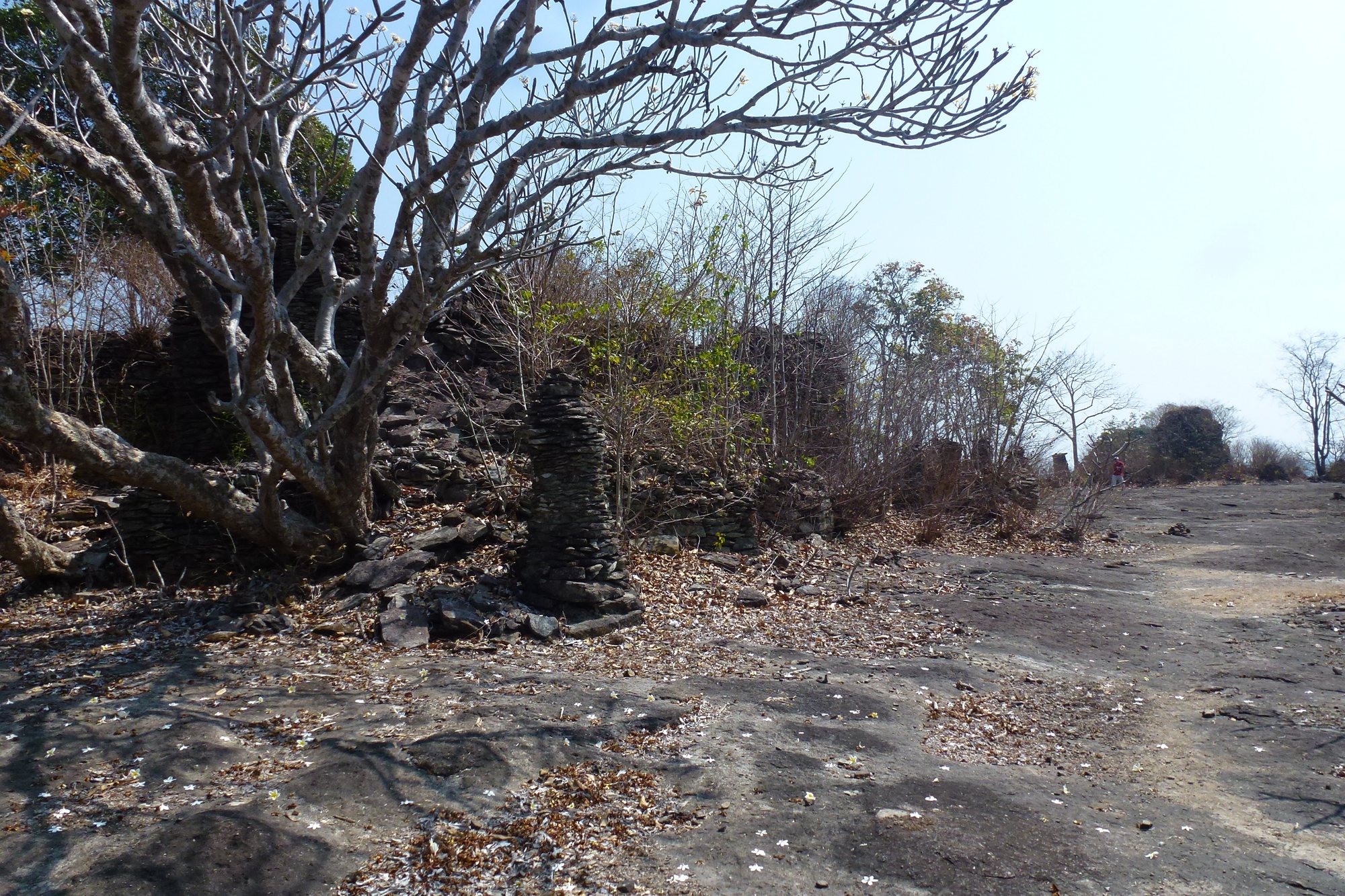
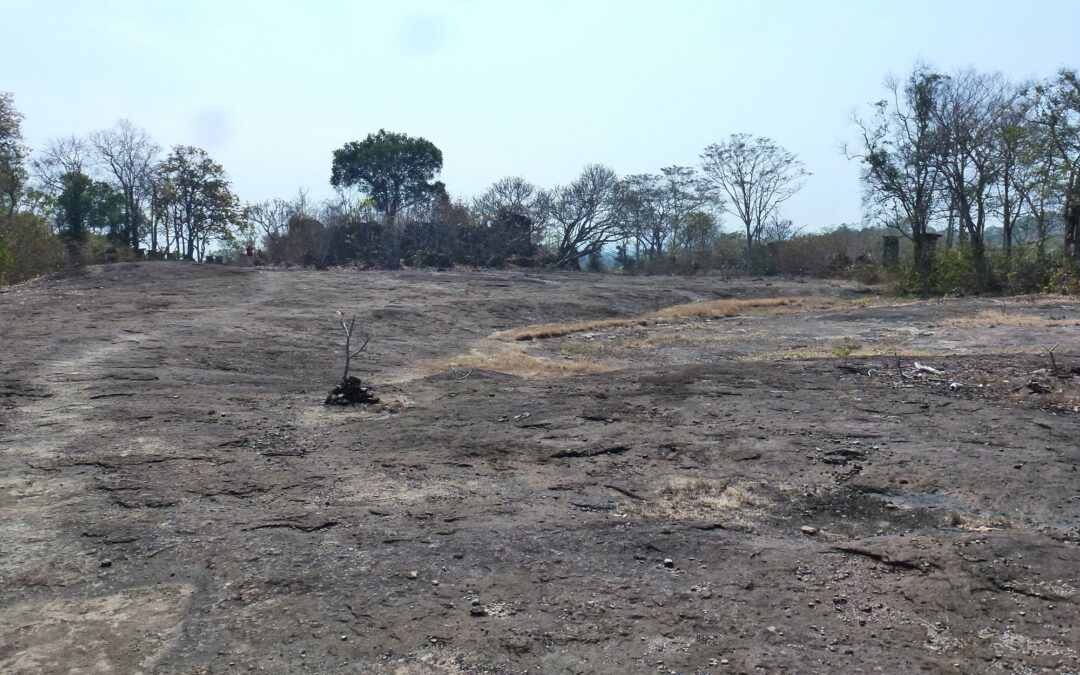
Above the village, Phou Asa is a wooded sandstone outcrop crowned by a bare rock platform. That is where the object of the climb sits: a rectangle of about one hundred and eight stone columns, each capped with a large flat slab, surrounding a central area that serves as a sanctuary. From a distance it looks like a mineral palisade; close up it is regular, methodical work, and plainly deliberate.
Nobody really knows what it is. The dates put forward hover around the tenth and eleventh centuries, and local tradition sees it as the fortress of a king of Attapeu — but nothing is settled, and the site has not yielded the inscription that would close the question. That is precisely what makes the visit enjoyable: there is no right answer to find, only a strange, high, windy place with a clear view over the marsh and the forest.
The climb is short but real: a path up through the undergrowth, then the last stretch in the open on bare rock. Wear shoes you can walk in, take water, and start early — after ten o’clock the summit platform offers no shade at all.
The village and its elephants
Kiet Ngong is known throughout the south as a mahout village: elephants have been kept and worked here for generations, first for timber, later for visitors. You still come across animals in the village, and rides are offered.
We do not recommend them. There is now a broad consensus on the subject among vets and conservation organisations, and the climb up Phou Asa is perfectly manageable on foot. That takes nothing away from the village: the relationship between Kiet Ngong and its elephants is part of its history, it can be explained and told, and the villagers also organise walks, birdwatching and bungalow stays facing the marsh.
Getting there from Champasak
Kiet Ngong is in Pathoumphone district, about 55 kilometres south of Pakse, on the east side. From Champasak you therefore cross the Mekong, then run south; it is a generous half-day out rather than a trip round the corner.
The simplest plan is to leave early, climb Phou Asa in the cool, come back down to the marsh when the light gets hard, and return for lunch. Our travel desk arranges the vehicle and the guide; it is also possible to book on the spot, at the tourist information office in Pakse or directly with the village, which runs its own tourism. The transfer page explains how we arrange journeys in the region.
If you have a second day to place, Kiet Ngong goes well with a run up to the Bolaven Plateau: the same general direction, two completely different environments, and two ways of seeing what geography does to southern Laos.
When to go
The season changes everything here, more than elsewhere. From November to February the air is dry and cool, the tracks are firm, walking is easy and it is also the best period for birdwatching. From March to May the heat becomes difficult on the summit platform, which has not a single tree. From June to October the marsh is full, the forest is at its greenest and the landscape is at its finest — but the last kilometres of track can be awkward and the climb slippery.
In every case, it is a morning outing. Our guide on when to visit southern Laos gives the month-by-month detail, and our selection of the best things to do in Champasak shows how to fit this day into a stay. Residence Bassac is on the west bank, on the river: you will leave from the water and come back to it.
Photos of Phou Asa: Pierre André Leclercq, Wikimedia Commons — CC BY-SA 4.0.
Recent Comments