
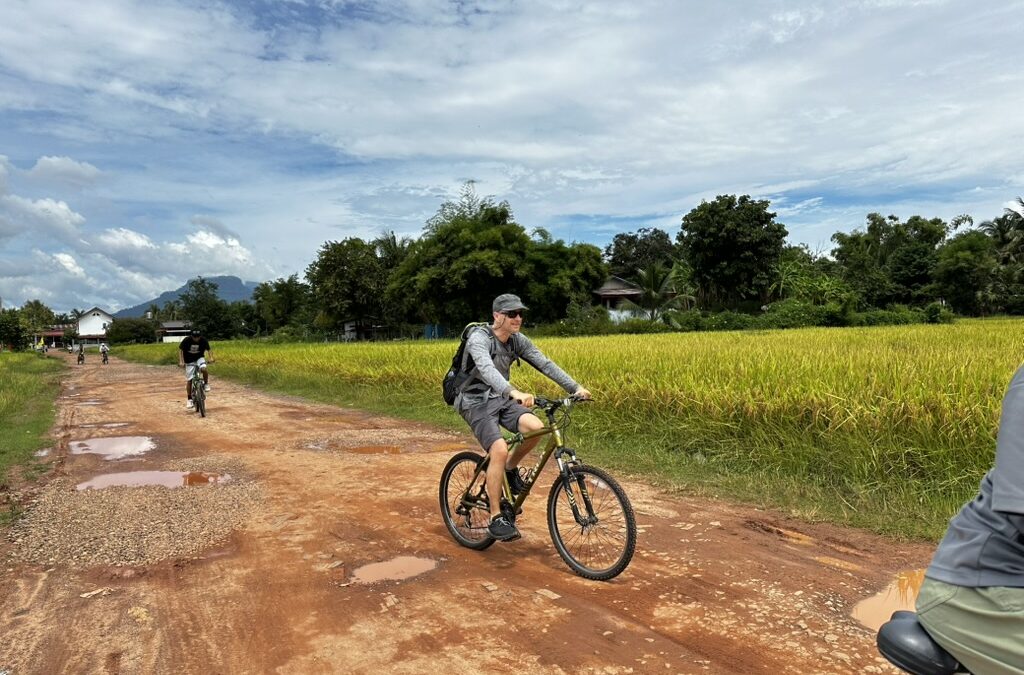
Cycling Champasak is the best way to understand this corner of southern Laos. Everything that matters here sits on a strip of land some fifteen kilometres long, between the Mekong and Phou Khao mountain. In a single unhurried day you can link the district’s oldest working temple, a royal city fifteen centuries old, a UNESCO-listed Khmer sanctuary, and two monuments standing at the head of the road that once ran all the way to Angkor.
Here is that route, in order, with the distances.
At a glance
- Distance: roughly 35 to 40 km if you do everything, return included.
- Time: a full day, with a long shaded break in the middle.
- Difficulty: easy, the terrain is flat. The only real obstacle is the heat.
- Surface: sealed as far as Wat Phou, apart from a few wooden plank bridges; laterite track beyond.
First stop: Wat Muang Kang, five kilometres south
Leave the village on the riverside road heading south. After about five kilometres, a gate on the left opens onto Wat Muang Kang, the oldest still-active temple in Champasak.
It dates from the 19th century and looks like nothing else in Laos. The sim, the ordination hall, rests on tall pillars beneath a steeply sloping roof. But it is the manuscript library, the hor tai, that stops everyone: a tower stacking Lao, Chinese, Vietnamese and French colonial influences one on top of another. Champasak was a trading crossroads, and this building tells that story better than any museum.
Local legend holds that a beam of light crosses the river, strikes a crystal held inside the tower and comes to rest on the summit of the sacred mountain above Wat Phou. Someone will tell you the story on site.
This is a living temple, not an archaeological site: monks live here. Cover shoulders and knees, and remove your shoes before entering the sim.
Second stop: the ancient city, between river and mountain
Riding back north and then taking the inland road, you cross, quite possibly without noticing, one of the most remarkable parts of the listed site: the ancient city of Muang Kao, also known as Vat Luang Kao.
The Champasak cultural landscape has been on the UNESCO World Heritage list since 2001, and the listing covers far more than the temple. It takes in a complete planned landscape, some ten kilometres long, laid out on an axis running from the summit of Phou Khao in the west to the bank of the Mekong in the east. The mountain stood for the dwelling of Shiva; the river, for the Ganges. Between them: two planned cities, temples, shrines and waterworks, developed between the 5th and 15th centuries.
Today you have to look for it. Earth banks, filled-in moats, alignments running through the rice fields. It is the kind of place you cannot see from a car and can just about read from a bicycle, going slowly.
Third stop: Wat Phou
Allow ten to fifteen kilometres between the village and the sanctuary depending where in town you start, around thirty minutes of gentle riding. The road is good. Two or three plank bridges are best walked, bike in hand.
Wat Phou deserves two hours at the very least. The site climbs in terraces from the barays, the ritual pools, up to the sanctuary set against the cliff. The higher you go, the narrower the stairway becomes and the wider the plain opens out below.
Come early. The stone heats quickly, the steps are steep and uneven, and the morning light is by far the best for photographing the carved pediments.
Fourth stop: Hong Nang Sida and the road to Angkor
This is the leg almost nobody does, and it is the day’s finest reward.
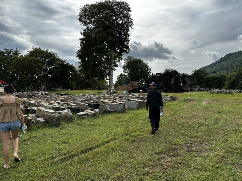
Two and a half kilometres south of Wat Phou, at the end of a laterite track, stands Hong Nang Sida, an early 12th-century Khmer sanctuary. It carries the name of a princess who, tradition says, gave her life to save her father’s; the king had this temple raised in her memory.
What makes the place matter goes beyond the building. Hong Nang Sida marks the starting point of a raised Khmer causeway running south: it passed Ban That and its three chapels some thirty kilometres on, and carried on to Angkor. You are standing at kilometre zero of an imperial road.
The temple has been undergoing restoration with South Korean support since 2013. The central shrine has been largely rebuilt; work continues on other structures. The state of the site therefore changes from one season to the next.
Fifth stop: Thao Tao, a hospital chapel of Jayavarman VII
A little further along the same track, still beside the ancient road, Thao Tao is the least visited monument here and one of the most eloquent.
It is an arogyasala: a hospital chapel. In the late 12th and early 13th centuries the Buddhist king Jayavarman VII had them built along the roads of his empire, each attached to a place of care. The sandstone shrine opens through an eastern porch; a laterite wall encloses it, pierced by an eastern gopura. The main tower has lost its upper structure but still stands, as do the gopura and most of the enclosure.
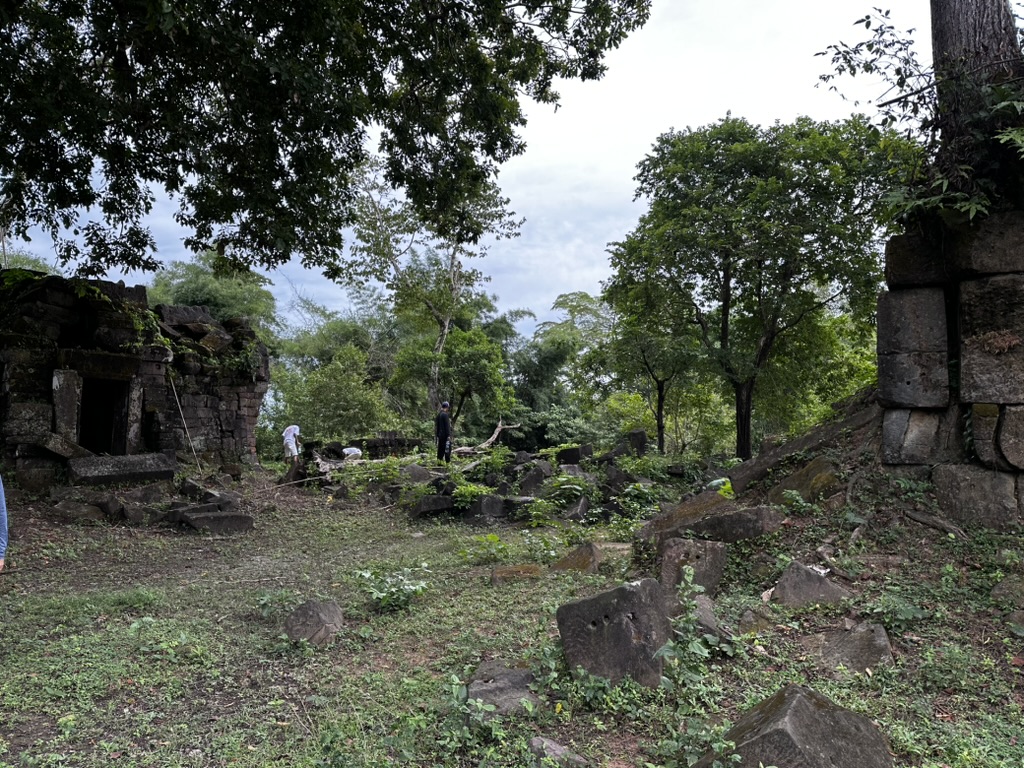
Five hospital chapels of this kind have been identified along the hundred or so kilometres between Wat Phou and the Lao-Cambodian border. Thao Tao is the northernmost, and probably the best preserved. The style is Bayon, the dedication Buddhist, to Lokeshvara: you are standing on the hinge between the Hindu world of Wat Phou and the Buddhism of Jayavarman VII, a few kilometres and three centuries apart.
What about the other bank?
Two major sites are not on the west bank and cannot be reached by bicycle from Champasak: Vat Tomo, a pre-Angkorian sanctuary buried in the forest of the east bank, and the island of the old prison. Both are reached by wooden boat from the village. That is a different day, and a different mood: see our activities.
When to ride
The dry season, November to April, gives the clearest skies and the most rideable tracks. It is also high season, and the time of the Boun Wat Phou festival in February.
The rainy season, May to October, transforms the landscape: vivid green rice fields, a high and wide Mekong, storm light. Downpours are heavy but short, and usually late in the afternoon. Riding in the morning solves the problem. The laterite track does fill with puddles, though: a mountain bike is far more comfortable than a town bike.
Either way, start early. Between 11am and 3pm the Champasak plain is a furnace with no shade.
Practical notes
| Start | Champasak village, west bank |
| Distance | ~35 to 40 km in total, return included |
| Climbing | None, apart from the Wat Phou stairways, which are done on foot |
| Surface | Sealed as far as Wat Phou (a few plank bridges), laterite track towards Hong Nang Sida and Thao Tao |
| Best timing | Leave at first light, be back before the midday heat |
| What to bring | Two litres of water per person, hat, sunscreen, shoulders and knees covered for the temples |
| Bicycles | Available to hire in the village; Residence Bassac reception also arranges the guided ride |
| Entry | Wat Phou charges admission and has set opening hours; Hong Nang Sida and Thao Tao are freely accessible. Worth checking before you go. |
Where to stay for an early start. Residence Bassac sits in the village itself, on the west bank, a few minutes’ pedalling from the start of the route. Our 14 rooms look onto the garden or the river, and breakfast is served on the Sala facing the Mekong, so you can be on the road before the heat. See also visiting Champasak and how to get here.
Recent Comments